Monday, October 18, 2010

Yangquan Shanxi China

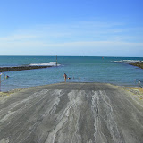
I am currently in Yangquan in China.
It is a very beautiful and interesting city
http://sunrise.today.wordpress.com

2010 The Year

October at Burrum Heads and this october in China..what a year of travelling it has been
http://sunrisetoday.wordpress.com

Temple and Mountains Wu Tai Shan at OneTrueMedia.com

Wu Tai Shan is in the mountains of Shanxi Province. It is known as the HolyCity with 120 Buddhist Temples.
http://sunrisetoday.wordpress.com

Ancient City Ping Yao China at OneTrueMedia.com

Ping Yao is the oldest city in China and the Ancient City is still in its original architecture and style.
http://sunrisetoday.wordpress.com

Noodle Maker Yangquan China at OneTrueMedia.com

Yangquan is famous for its noodles. here is the master noodle maker at work
http://sunrisetoday.wordpress.com

Nashan Park China at OneTrueMedia.com

Nashan Park is a park designed into Nashan Mountain at Yangquan.
http://sunrisetoday.wordpress.com

Shinaoshan Mountain China at OneTrueMedia.com

This is a video of climbing the mountain at Yangquan
http://sunrisetoday.wordpress.com

Monday, August 30, 2010

Yang Guan Pass of China Great Wall, Gansu Yang Pass, Yangguan Pictures

Yang Guan Pass of China Great Wall, Gansu Yang Pass, Yangguan Pictures

http://www.travelchinaguide.com/picture/china_great_wall/gansu/dunhuang/yangguan/
http://www.travelchinaguide.com/china_great_wall/scene/gansu/yangguan.htm
Located in Nanhu Village, along the Hexi Corridor and 43 miles southwest to Dunhuang City in Gansu Province, Yangguan Pass is one of the two important western passes (the other one is Yumenguan Pass) of Great Wall in Western Han Dynasty (206BC -24AD). The Emperor Wu ordered to build it in the purpose of consolidating the frontier defense as well as developing the remote western region.

In Chinese, Yang means the south. Because it is lying to the south of Yumenguan Pass, people gave its name - Yangguan Pass. Together with Yumenguan Pass, it has also witnessed the prosperity of Silk Road in the past times. In Tang Dynasty (618 - 907), it welcomed the glorious return of Xuan Zang, a great monk who pilgrimaged to the west in search of Buddhist scriptures. Many Chinese get to know this important pass mainly from the poem Farewell to Yuaner to Take Office in Anxi, written by Wang Wei, a famous poet in Tang Dynasty. From the last two lines "Oh, my friend, I sincerely entreat you to have another cup of wine; you will see no more friends west out of the Yangguan Pass.", we can see the Yanguan Pass has always been the place of desolation and sadness since ancient times. In the Song (960 - 1279) and Ming (1368 - 1644) Dynasty, because of the decline of the Silk Road, the Pass was generally forgotten by people.


Gansu Yangguan Pass bricks
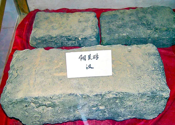
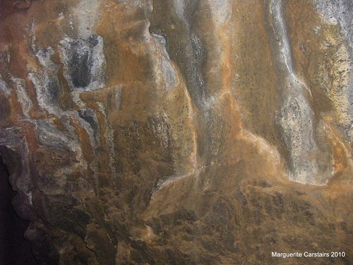
Yangguan bricks in Yangguan Pass Museum
For years and years, the flowing dunes have eroded this Great Wall pass into a broken beacon tower, standing alone in the boundless desert. It measures 15.4 feet high and 8.7 yards wide. Around the relic, you cannot even see the dismantled walls, because they were all eroded by the wind and buried under earth. South to the pass, there is a "Curio Beach". It is a small valley where you can find lots of dynasties' tiles, coins, weapons, and decorations.

Today's Yangguan Pass is not only a historic place of recalling the remote past, but also a hometown of tasty grapes. Come here, appreciate the beauty of vicissitudes of the Great Wall, enjoy the natural view combined by oasis, desert and snow peaks, and taste the juicy fruits.

Yangquan Travel Guide: Location, Scenic Spots, Shanxi China

http://www.travelchinaguide.com/picture/china_great_wall/gansu/dunhuang/yangguan/

Yangquan Travel Guide: Location, Scenic Spots, Shanxi China

Population: 1,289,500

Area: 4,451 square kilometers (1,719 square miles)

Nationalities: Han

Administrative Division: 3 districts (Downtown District, Mining District, Suburban DIstrict); 2 counties (Pingding, Yuxian)

Useful Telephone Numbers:
Tourist Complaints: 0353-2042817
Weather Forecast: 121
Zip Code Inquiry: 184
Bank of China: 0353-2024446

Location: Yangquan lies at the western foot of the middle Taihang Mountains, it is the political, economic and cultural center of the eastern Shanxi Province, and is adjacent to Hebei Province in the east, located midway between Shijiazhuang and Taiyuan and about 400 kilometers (249 miles) from Beijing and Tianjin.

Physical Features: The city is situated on the eastern edge of the Loess Plateau in the mountainous area of eastern Shanxi. The terrain of the city slopes downward from the west to the east with the mountains as its main part of the land.

History: Yangquan is a time-honored city and gains its name for the five bubbling springs of former days in the downtown city. Historically, it was always a strategic point that commenced construction as a military fortress as early as in the late Warring States Period (476BC-221BC). In the Tang Dynasty (618-907), Yangquan was exalted to a prefecture. By 1905, it had a train station to facilitate the exploitation of the mines, making the city one of the birthplaces of Shanxi's modern industry.

Climatic Features: It belongs to the warm temperate zone with a semi-humid continental monsoon climate, Yangquan has four clear seasons: windy and rarely rainy spring; hot and wet summer; cool autumn and cold dry winter. Additionally, winter and summer are longer whilst spring and autumn are shorter. As the weather can be rapidly changeable in autumn, temperature difference between the day and night is great.

When to Go: from April to October of a year

Scenic Spots:
Niangzi Pass: Apart from the sites of old berm, the gate and the wall, this pass of the Great Wall also has a waterfall nearby which counteracts the occasional pervading gloom.

Nanshan Park: It is a comprehensive hilly park that assembles imitations of ancient buildings, fountains, pavilions, and children's playground. It is a perfect place for people to relax.

Other Scenic Spots: In northeastern Yuxian County, there are a group of karst caves extending for 20 kilometers (12 miles) with the largest one half kilometer (0.3 mile) long. It is one of the largest caves in North China.

Shanxi Province...Yangquan


Shanxi (help·info) (Chinese: 山西; pinyin: Shānxī; Wade–Giles: Shan-hsi; Postal map spelling: Shansi) is a province in the northern part of the People's Republic of China. Its one-character abbreviation is Jin (晋 pinyin jìn), after the state of Jin that existed here during the Spring and Autumn Period.

The name Shanxi literally means "mountain's west", which refers to the province's location west of the Taihang Mountains.[1] Shanxi borders Hebei to the east, Henan to the south, Shaanxi to the west, and Inner Mongolia to the north. The capital of the province is Taiyuan.

http://en.wikipedia.org/wiki/Shanxi


* Jinci in Taiyuan, famous for its temples and Song Dynasty paintings and architectures.

* Zuoquan County, famous for its China Communist Party battlefield sites.

* The Ancient City of Pingyao is a World Heritage Site near Taiyuan. Once a great financial center of China, it is noted for its preservation of many features of northern Han Chinese culture, architecture, and way of life during the Ming and Qing Dynasties.

* The Yungang Grottoes, a World Heritage Site in Datong, consist of 252 caves noted for their collection of 5th and 6th century Buddhist grotto sculptures and reliefs.

* Mount Wutai (Wutai Shan) is the highest point in the province. It is known as the residence of the bodhisattva Manjusri, and as a result is also a major Buddhist pilgrimage destination, with many temples and natural sights. Points of interest include Tang Dynasty (618–907) era timber halls located at Nanchan Temple and Foguang Temple, as well as a giant white stupa at Tayuan Temple built during the Ming Dynasty (1368–1644).

* Mount Hengshan (Heng Shan), in Hunyuan County, is one of the "Five Great Peaks" of China, and is also a major Taoist site. Not far from Heng Shan, the Hanging Temple is located on the side of a cliff and has survived for 1400 years despite earthquakes in the area.

* Pagoda of Fogong Temple, in Ying County, is a pagoda built in 1056 during the Liao Dynasty. It is octagonal with nine levels (five are visible from outside), and at 67 m (220 ft) in height, it is currently the tallest wooden pagoda in the world. It is also the oldest fully-wooden pagoda in China, although many no-longer-existing wooden pagodas have preceded it, and many existing stone and brick pagodas predate it by centuries.

* Hukou Waterfall is located in the Yellow River on the Shanxi-Shaanxi border. At 50 meters high it is the second highest waterfall in China.

* Dazhai is a village in Xiyang County. Situated in hilly, difficult terrain, it was a holy site during the Cultural Revolution, when it was set out to the entire nation as exemplary of the hardiness of the proletariat, especially peasants.

* The Cloud Ridge Caves are shallow caves near Datong. There are over 50,000 carved images and statues of Buddhas and Boddhisatvas within these grottoes, ranging from 4 centimeters to 7 meters tall.

Monday, August 23, 2010

Childers Queensland Australia

Lace verandah of the Childers Art Gallery


http://www.smh.com.au/news/Queensland/Childers/2005/02/17/1108500202242.html


Well preserved historic town on the main road between Brisbane and Bundaberg.
Located 325 km north of Brisbane, 60 km north of Maryborough, 52 km south of Bundaberg and 108 m above sea level, Childers is a town which was created and sustained by the sugar cane which grew around it until there were 8 years of drought. The local council, determined to capitalise on the tourist traffic which drove through town without stopping, then embarked on a campaign which has resulted in the title 'Historic Childers - The National Trust Town' and now offers people speeding north to the resorts an ideal place to stop and explore a little of the region's interesting past.

Given the age of the unusual Brazilian Leopard Trees which line the main street it is surprising that people ever drove through the town without so much as a pause of curiosity.

The Childers area was first explored by Europeans in the 1850s. The name of the town of Childers comes either from the village of Childre in Oxfordshire (there are other Oxfordshire names in the area including Didcot, Abingdon and the Isis River) or from the Rt Hon Hugh Childers, Auditor-General of Victoria.

The area grew slowly as teamsters stopped in the town and the land around was taken up by pastoralists eager to raise cattle on the fertile soil. In 1902 the town was virtually wiped out by a fire which demolished nearly all the buildings on one side of the main street. Those that survived are now the interesting and important buildings in the town.


RSL Club

Wind Farm at Ravenshoe Queensland Australia

Waiting for the wind


Windy Hill Wind Farm is a wind power station near Ravenshoe on the Atherton Tablelands, Queensland, Australia. Windy Hill has 20 wind turbines with a generating capacity of 12MW of electricity.

The power station was commissioned in 2000 and was initially operated by the Stanwell Corporation. However, as of December 2007, Windy Hill was sold to Transfield Services Infrastructure Fund as part of Queensland Government's ClimateSmart 2050 strategy.

http://www.cleanenergycouncil.org.au/cec/resourcecentre/casestudies/Wind/Windy-Hill.html


Windy Hill Wind Farm is Queensland's largest wind farm with 20 windmills producing enough power for 3500 homes.
Windy Hill Wind Farm is located about three kilometres from Ravenshoe, which is situated 920 metres above sea level (highest town in Queensland,) on privately owned Atherton Tableland dairy farmland.
It is capable of a generating capacity of 12 megawatts, and the number of wind turbines is 20.

Wind turbine operation

Phase 1 of Windy Hill wind farm consists of 20 turbines with a combined capacity of 12 MW. The turbines are Enercon E40, each with an electrical capacity of 600 kW. The turbines are mounted on tubular towers 44 metres high, the hub height is 46 metres. The rotors have total diameters of 46 metres. The blades pitch to optimise the power produced and to control the rotational speed. The turbine rotates from 14 rpm to 38 rpm maximum.

The rated output is produced at wind speeds of between 13 m/s (47 km/hour) and 25 m/s (90 km/hour), the cut-in wind speed is 2.5 m/s (9 km/hour).
Transmission

Power is generated at 400 volts and is stepped up to 22,000 volts with a transformer for connection to the grid. The turbines are connected through underground cables before being connected to the overhead transmission lines passing through the wind farm. Ergon has constructed a new substation closer to Ravenshoe to enable the wind farm power to join the 66kV service to the Tablelands and North Queensland.
Site Ownership

Stanwell Corporation does not own the land around the wind farm. Two local farmers have entered into lease access agreements with Stanwell. The wind turbines have minimal impact on their activities and the farmers continue with normal land use.
Phase 2

Phase 2 of the project is planned to consist of another 22 turbines, taking the total capacity to 25 MW. The project will proceed if the Shire Council and the local community are fully satisfied with project impacts.
Environmental impact

Windy Hill's 12 MW wind farm will produce enough energy to supply 3500 homes (equivalent to the towns of Atherton and Mareeba) and will reduce carbon dioxide emissions from non-renewable sources by 25,000 tonnes. Stanwell undertook wind monitoring to assess the potential of the site and optimum turbine layout. The consultation process with stakeholders considered issues such as aesthetics, impact on wildlife, noise levels and compatibility with telecommunications systems.

From the Road

Karumba Queensland Australia

Karumba-Fishing and prawn trawlers


http://www.smh.com.au/news/Queensland/Karumba/2005/02/17/1108500203462.html

Karumba (including Sweers Island)
The major fishing port on the Gulf of Carpentaria.
Located on the banks of the Norman River 69 km from Normanton and 443 km north of Cloncurry, Karumba is a fishing town. It is nothing more than a port, a few shops, a pub, a lot of inexpensive accommodation for fishermen and a river front which abounds with wharves, refrigerated storage areas, slipways and engineering services.

In the 1870s a telegraph station was built on the site of the present town. It was known simply as Norman Mouth. It served a purpose but was hardly reason for a settlement to develop. Karumba first came to importance in the 1930s when it became a stopover point for flying boats on the run from London to Australia. By the 1950s it had become a popular spot for people eager to go fishing in the Gulf of Carpentaria.

The town went through something of a boom period in the 1960s and 1970s when it became the centre for the Gulf fishing industry. Today the prawn fishing industry and the barramundi industry earn over $130 million each year.

Karumba itself is an unimpressive town. It looks like any hastily thrown together coastal settlement. Lots of fibro and haphazard urgency. Most of the houses look like holiday homes and the town has a temporary feeling about it.

Karumba's existence is connected to the simple fact that it is on the banks of the river and it is set on sand ridges which allow direct access to the river and the sea. As Burke and Wills found out in 1861 large areas of the Gulf's coastline are inpenetrable because of the dense mangrove swamps. In fact the bank of the river opposite the town is still inpenetrable mangroves.

The journey to the town from Normanton passes over an area of very flat Gulf Country. The land is alive with birdlife and it is common to see flocks of cranes and brolgas feeding beside the road.

A sign outside the town seems to sum it up 'Welcome to Karumba - population small'. As the road enters the town the all-pervading fishing industry becomes obvious with signs like - Karumba Marine Service, Karumba Charter, Net Mending and Seafood Supplies. Even the police station has a boat outside it.

In spite of its industry there is something quite beautiful and exotic about the place.

Karumba-pier

Karumba North Queensland..the Sunset

Karumba-Sunset 12 July Barge


Karumba is famous for its magnificent sunsets.
Tours regularly take boatloads of tourists to sit in the middle of the ocean out of Karumba, in what is like a bowl of sunset to enjoy the spectacular changing of colors as the sunset deepens and changes and finally burns to the night.


Karumba-172

Undarra Resort Queensland Australia

Looking out


http://undara.com.au/

Set in the Gulf Savannah country, Undara is as ancient and alluring as the continent itself, the Undara Lava Tubes stand as silent sentinels to our pre-history. Here you can walk in the path of a volcano and sleep cocooned in an antique railway carriage as your dreams connect you with the essence of this timeless land.

It’s a place where you can explore natural geological wonders, enjoy the comforts and hospitality of a unique outback setting and where the local wildlife are as abundant as they are at home in their surroundings. In short, Undara needs to be experienced!

A short flight, historic train ride or scenic half-day coach transfer or drive from Cairns, Undara is the experience that defines Australia’s Outback.
You’ve heard it said “You have to get lost to find yourself” – this is where you’ll find the sense of place you’re seeking…

Undara Experience is Located on the eastern edge of the ruggedly beautiful Gulf Savannah region of northern Australia, the multi-award winning Undara Experience captures the essence of the real Australian Outback.

Undara Experience is located in pristine tropical savannah woodlands, within easy reach of the Great Barrier Reef areas of Cairns and Townsville in Tropical North Queensland.

From Undara Experience, you can visit the Undara Lava Tubes, part of the longest lava flow from a single volcanic crater on Earth. In the Microbat breeding season you can witness the unique spectacle of the Microbats and the Night Tigers.

Your stay at Undara Experience includes evening wildlife spotlighting walks, campfire evenings, delicious dining featuring the region’s best produce, or a quiet drink in the bar as the outback sunset fades into the clearest starlit night.

 Highly qualified Savannah Guides take you on tours that give a unique insight into the geology and ecology of the Undara Volcanic National Park, the local history and bushcraft of the Gulf Savannah region.
Tours cost $45 from the Resort.

Earthy colors of the walls

Mission Beach.. Tam O'Shanter National Park..Djuru National Park

Undergrowth

http://www.derm.qld.gov.au/parks/djiru/index.html


The Traditional Owners of Djiru National Park, the Djiru Aboriginal people, welcome you to their country and ask that you respect their special place.
Location
Eight kilometres west of the town of Mission Beach

This park protects some of the last remaining lowland rainforest in the Wet Tropics and is home to the endangered southern cassowary. Two separate day-use areas feature pleasant rainforest walks and a longer bushwalk links the areas.

The Rain forest walk takes about 30 minutes walking through some very dense tropical rain forests which are home to the Cassowary. The walk is well created fully documented with detailed noticeboards and information, and stepped and designed to maintain the natural rainforest.

Wongaling Beach south of Mission Beach Queensland Australia

Beach


Mission Beach is a natural mid way point between Townsville and Cairns. Mission Beach is made up of four beach villages linked by 14 kilometres of wide golden beach, a perfect base to relax and explore this unspoilt natural environment. A blend of sophisticated eateries, boutiques and art galleries nestle against lush tropical rainforest. Mission Beach reminds us of how beautiful little beachside towns can be, blending vibrant art and culture with unique tourism attractions.

Visitors to Tropical North Queensland can plan a day trip from Cairns or Port Douglas; it’s just under two hours from Cairns to Mission Beach. Experiencing the beauty of Mission Beach, Cairns visitors often return.

The four villages of Mission Beach offer an excellent array of accommodation, from luxury resorts, and upmarket holiday homes to secluded rainforest retreats and superbly appointed B & Bs. Romantic getaways, family holidays, birdwatchers, backpackers, adventure travellers, campers and caravanners are all catered for. Mission Beach also offers the tourist a vast array of activities ranging from eco-friendly and environmental tours to extreme sports such as tandem skydiving and white water rafting for adrenaline junkies.

Wongaling Beach is the closest point to Dunk Island and enjoys spectacular views. Launch your boat directly off the beach or catch the water taxi to Dunk Island. Alternatively, take in the shops at the Wongaling shopping centre or enjoy a beer with your lunch in one of the beachfront bars.

Waves on the shore

Balgal Beach Queensland Australia

Balgal Beach


Balgal Beach is a beachside community popular as a day and overnight trip destination for locals and tourists to Thuringowa and Townsville. Just a few minutes from Rollingstone, Balgal Beach features a stinger net, which is installed and patrolled from November to May, and an excellent boat ramp facility with easy access to the Palm Island group. It boasts a superb sand beach as well as a wide creek mouth and is a renowned beach and river fishing location.

Other activities include visiting the Anzac memorial, viewing the interpretive historic signage, having a picnic and barbecue at the park, bird watching and fishing.

There is also a licensed cafe and a variety of accommodation which includes Holiday Units, Bed and Breakfast Retreat, and Council's two designated limited tent camping and vehicle camping areas. Download the flyer from their websites for more information on free camping.

Balgal Beach

St Lawrence Queensland Australia

St Lawrence River

http://www.flickr.com/photos/ladymaggic/sets/72157624574525026/

St Lawrence
Tiny township between Rockhampton and Mackay.
Located 823 km north of Brisbane St Lawrence is a tiny, insignificant town which through some accident of history and location has managed to survive although it has outlived its usefulness. It sprawls around the railway line and, to the casual observer, seems to have no real reason for its continued existence.

Originally it was created as a port to ship out the cattle which were grazed in the hinterland. Its existence depended almost entirely on the fact that it was located midway between the larger ports of Rockhampton and Mackay and, as such, was a sensible alternative to the relatively long droving runs which were required if cattle were to be shipped out from these larger ports. It is located 183 km from Rockhampton and 161 km from Mackay and it is now 6 km from the Bruce Highway consequently it doesn't benefit from the passing traffic.

Today it is nothing more than a strange country pub, a little butcher's shop, a couple of general stores, a railway station, a bowls club (which is a very popular weekend pastime), and a shire council office. The people in this tiny settlement are almost entirely shire and railway workers with just a few professional fishermen and local business people.

View across the river

Thursday, August 19, 2010

Wednesday, August 11, 2010

Where the Hell is Matt? (2008)

Philipines..Dumaguette


http://www.dumagueteinfo.com/
 Dumaguete City is known as 'The City of Gentle People' and for good reason. While the Philippines in general is famous for their hospitality,

Birds at Normanton Queensland Australia


Normanton
Unusual and fascinating town near the coast of the Gulf of Carpentaria.
Normanton is a genuinely delightful town with an excess of old world charm. Located 712 km west of Cairns and 681 km west of Townsville it started life as a port for the Gulf of Carpentaria's cattle industry and grew in importance with the discovery of gold at Croydon in 1885.
The area was first explored by Ludwig Leichhardt on his epic journey from the Darling Downs to Port Essington. The next Europeans through the area were Burke and Wills who made their final dash to the Gulf (or, more correctly, to the mangrove swamps somewhere near the edge of the Gulf) only 26 km west of the town.
The location of Burke and Wills last northern camp is signposted on the main Normanton-Burketown road. It is only a 1.5-km drive into the bush to the spot which is marked by a couple of plaques.
The dedication reads: 'This monument marks the site of Camp No: 119 of the 1860-61 Burke and Wills expedition occupied on Saturday 9 February 1861 by Robert O'Hara Burke, William John Wills, John King and Charlie Gray. On Sunday 10 February Burke and Wills left on the attempted journey to the Gulf of Carpentaria returning on Tuesday 12 February. All four abandoned the camp the next day for the return journey to Coopers Creek, Depot No: 75, and home to Melbourne. During the return journey all died with the exception of King who survived with the assistance of a friendly Aboriginal tribe. This monument was provided through, and with thanks, to the generous donation of Mr. Douglas Jolly of Brisbane and the historical advice of the State Library of Victoria and was erected in 1978 by the Normanton Lions Club.'
It was Frederick Walker, one of the many explorers who went looking for Burke and Wills, who discovered and named the Norman River after the captain of a ship named Victoria.
In 1867 William Landsborough sailed up the Norman river and chose the site for the settlement of Normanton. Over the next decade it became an important port. The large Burns Philp building at the end of the town's main street is evidence of its importance at this time. There were even suggestions that it would become a port to rival Darwin as the main centre on the north coast of Australia.
In 1892 a boiling-down works was established on the river and shortly afterwards a meatworks was opened.
The town experienced a major boom with the discovery of gold at Croydon. By 1891 the population had reached 1251. However the gold diggings were short-lived and although the Normanton-Croydon railway line was opened by 1907 the whole area was on the decline. Even the cattle which had been the town's mainstay started heading south as the railway line was extended out towards Mount Isa. By 1947 the population had dropped to 234.

http://www.smh.com.au/news/Queensland/Normanton/2005/02/17/1108500203650.html


Great Wall of China at Jinshanling and Simatai

http://www.kinabaloo.com/simatai_great_wall.html
SiMaTai Great Wall, 120 km northeast of Beijing, is 5.4 km long with 35 beacon towers. Simatai Great Wall is known for its steepness, Ruggedness and beauty                                                                                                   
SiMaTai is densely dotted with watchtowers; the nearest two are only 44m apart. The walls are in single, double and trapeze forms and the watchtowers are sometimes round in shape and composed of 2 or 3 floors. Even the roofs of the towers are diverse: some are flat, some cymbi form and some domical shapes.
There are two springs called the 'Mandarin Duck Springs' at the foot of SiMaTai Great Wall. The east one is cold, while the west is warm. The 2 springs join into one lake so half the lake is cold and the other half is warm. In winter, hot steam rises from the lake, forming a marvelous spectacle.
SiMaTai Great Wall is separated into two parts (east and west) by a valley. The west part is relatively gentle with 20 well-preserved watchtowers. The east part is steep and precipitous with 15 watchtowers on the 1000 m high peaks, making a journey you will never forget.

Monday, May 31, 2010

Working at a cattle Station at Normanton Queensland Australia


31 May 2010
Trip took 3 days..first night at Camilalla Beach, then 45 kms past Bowen and then Ravenshoe and here...2,012 kms distance traveled.
Was very exciting. Loved the trip and found the roads and weather excellent. The Toyota drove well..was wonderful trip.

Love the property. Its right next to a lagoon and very green and very beautiful. Will do photos next week. I can use the internet weekly so will prepare for it. Its a very beautiful part of the world, many birds and trees and beautiful colors. Love the people I am working for..Bill and Maxine and the team love my cooking. I shall never want to leave here I can see.

So far done nothing but cook. Today the muster started. It is done with a helicopter who finds the cattle and directs the team to collect them and take them to the fenced areas for all they do to them. Then it takes 5 days for this lot to be done, and then the helicopter comes for the next part. I will know more as I see it happening. I hope to be poking around the sheds with a camera and get some photos...want one of the cattle being led in, dust around, as they come towards the shed.

They killed a hige beast for meat, and I have mince and steaks and huge roasts to prepare. The guys will eat 2 Porterhouse a meal. I am amazed. I have never seen so much meat before. Last night I cooked  salted meat for lunch today. They make their own salt beef here and its delicious. Cooked in in a crock pot overnight.
Today I will make a huge roast fort tomorrows lunch, and have steaks for dinner when they return. They have taken a cut lunch...sandwiches, cake, scones and fruit. They eat very well here. I am sure I will be fat in 2 months with all this good cooking, and eating, I am doing here.

This is this weeks adventure...today the muster has started, and soon the yards will be full of brahmin and motor bikes, and action.

1 June 2010

Yesterday the muster started. A helicopter locates the cattle, and then they are driven down to the house yards.
Today they will dip them and inject them after sorting them into weiners, calves, pregnant and fat. This property is a breeding property where they breed Brahmin cattle.
The property is one of a few properties. Others fatten for the overseas market. The meat from here goes overseas. It is of a very high quality. The meat that was killed for the kitchen has so far been a flap roast, salted meat and an irish stew, and the food is delicious as the quality of the meat, and vegetables here, is very high.
On the way at Milla Milla I saw a tea plantation and bought some local tea which has a wonderful flavor. The countryside between Innidfail and Ravenhoe is all very mountainous. That is where the tea grows. I also took photos of a Wind farm. Ravenshoe claims to be Australia's highest town.
It was scary driving up these steep inclines in the first and second gear. The views were spectacular but as the driver, I was more concerned with getting the van up the hill and over.

Today the team are giving the 600 cattle in the yard injections and the dip. They will work these cattle for about 5 days and then the helicopter will return for the next muster. I hope to get some aerial shots if I get lucky.

Friday, May 21, 2010

Sarah is running around Australia

Blogger: Coastal Art-Maggi - Publish Status

Sarahs Journal

Cairns

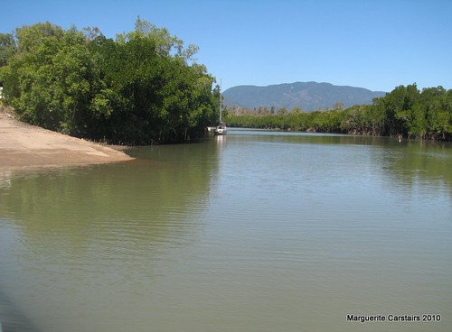
Cairns welcomed us with a fantastic stay at Coconut Palms BIG 4 Resort. The kids have had a chance to play with other holiday makers, relax and rest up ahead of the journey accross the Savannah Way towards Darwin. We were able to take the kids on the Sky Rail and Kuranda Scenic Rail. I really enjoyed sharing thier delight at the sights but alas, reality soon caught up and it was back on with the running shoes to face the hills to Kuranda on foot. The strecth to Mareeba was a welcome contrasting plateau. Atherton was next.

Townsville

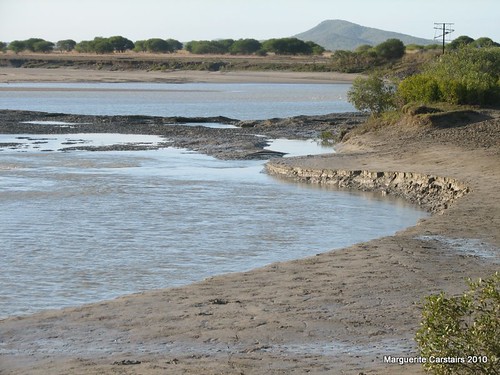
Another humid 60km under the belt. Channel 7 and Win tv interviews done, it was time to hit the beach here in Townsville and let the kids play in the gentle surf. Woodlands BIG 4 Caravan Park let us stay for 2 nights. The support vehilcle shuttled a tired me back to there after the days running. Lack of road shoulders meant that the support car would let me run ahead for about 2 km, then catch me up, offering a drink of water before letting me run ahead again. I had to step off the road as 3 wide load trucks went by with demountables on them.... getting desperate for entertainment up here!!!

Day 29: Rockhampton

29-3

Rockhampton was full of friendly people. Robby from Ascot Stone Grill invited us all to a scrumptious meal at Ascot Backpackers, good hot showers all round were welcome. Then things started to go wrong mechanically, luckilly right in Rockhampton itself. Toyota took the car in for a quick new clutch. Thank goodness for warentee!

Day 24 Bundaberg

the park

At last, nice flat terain, nice big town, Beaurepaires put 6 NEW wheels on the bus, THANKYOU!!!

Also a Huge thankyou to The COSY CORNER INTERNET CAFE who stayed open til nearly midnight so Kadi could update the website. I spoke on the radio later the next day after another flat 30km north out of Bundaberg.

Lovely seafood and farm fresh produce along the way... all makes for happy running. We were invited to a farm out near 1770 by a motorist who stopped to talk to us at a fuel station. We took a detour during the day. I soon forgot about my tiredness and enjoyed the short day break out to the beach at 1770, Agnes Water and their farm. Ajay and Susie made us feel at home, letting us camp up for the night and showed us around their property. They taught us some natural tie-dying methods form plant based dies around their farm. The team helped out Ajay that afternoon with some fencing in return for their lovely hospitality. We had roast pig for dinner, the whole pig, which was recently slaughtered rotated on a spit as we sat around the campfire and relaxed

Tuesday, April 20, 2010

Chaohu China

 Chaohu Farm: April 5th 2008...the Rapeseed is in full flower and 
the fields from Hefei to Chaohu were golden with the flowers.It was very
 beautiful.Here is King as we walk through the fields of Flowers on 
Saturday at ChaohuChaohu Farm: April 5th 2008...the Rapeseed is in full flower and the fields from Hefei to Chaohu were golden with the flowers.It was very beautiful.Here is King as we walk through the fields of Flowers on Saturday at Chaohu
I have just returned from the most wonderful weekend, staying on a farm, in the small Rural village at Chaohu, where I stayed with King and his family in a beautiful white brick home in the middle of picturesque rice fields with Rapeseed in full golden flower. Here I enjoyed the most generous hospitality and friendship, and experienced real Rural China for the first time.
His father is a school teacher and his mother works the farm which produces a crop of Rapeseed, some wheat and rice. Rapeseed  is used to make vegetable oil, and they also produce  all the vegetables needed by the family, as well as eggs, chickens and ducks. Their farm is one of many small farms in a small Community where the people work together as a community and share the fields and community life. I also visited a Chicken farm and saw how the chickens are grown for commercial sale in large quantities in warmed huts where they simply eat and grow ready for the market.
The neighbours came to meet me, and it was wonderful sharing their lives and smiles, for this weekend.
This was a special weekend, as it was Qingming, a Public Holiday for cleaning the tombs of the Ancestors. The tombs were decorated with shining streams of colored tinsel after the family visited it with Prayer Paper, symbolic money and fireworks to scare away bad spirits. The most meaningful part was the paying of respect to the ancestor with a small prayer. The tombs were all visible because of the decoration.
King's Mother is a quality cook, and the meals were fantastic. I saw the duck being defeathered and cleaned, and then enjoyed it in a delectable dish alongside chicken, pork, waterlily, mushroom, broadbeans, bok choi, fresh fish, salted fish and salted duck, preserved eggs, even shrimps in a tangy sauce. Every meal was a gourmet delight, and accompanied by beer in tiny glasses, friendly toasts and much good spirits.
On Saturday we went to climb the mountain. Somehow we wandered across fields passing geese, and ducks, and one barking dog, an ox ploughing the rice field, and beekeepers collecting the honey from the hives. We climbed straight up the mountain following a very small track that led us past women picking wild tea on the slopes, and boys walking up rock faces. It was a very hard climb to the top to see Tiger Mountain and the scenery down below in every direction. I was scared because of the slippery track and the prickly thorn bushes we had to find our way through.
Then came the hardest part, winding our way back through the unknown on almost vertical slopes until we eventually came to the lake, after four hours of walking...straight up and then straight down a mountain.
It was quite a relief to see tombs of ancestors as that meant the village was not far away, and as we crossed the lake in the gathering evening light, we saw the hives and the Honey factory where we purchased some of the sweetest, most delectable and pure, golden honey, direct from the bees you can say, as the workers were draining the honey from the wax laden hivs, as we waited. 
The whole walk was very beautiful, and we enjoyed the experience. As we started back, the rain came, and so did King's father with a huge black umbrella, and we made it back home without getting too soaked.
The morning was spent walking over the fields listening to bird songs, watching the tadpoles and the tiny green frogs, and walking through fields of golden rapeseed in full tonings of gold with small pods forming below the flowers. The paths were rich in wildflowers...tiny violets, small wild orchids, small white daisies, buttercup, pink clover flowers, and purple lilac like creepers that poured out of the earth. The rice fields were rich with seed for the chickens, as it is ploughing and preparing time now in Spring. The vegetables were green and healthy, and there was spinach, potatoes, celery, and wheat growing green and rich. We even saw a snake, and King caught it and held it for us to view before sending it into the water to swim away smoothly out of sight. There were Magpies, and sparrows, and holes where the weasels lived. It was such a glorious adventure following King as he showed us his home. The ponds were spindly with new reeds budding in the mud, and the peach trees shed pink blossom on the waters of the small streams that ran through the homes and was the base for washing and cleaning.
There is a small rocky, fast river crossing the property and we saw large, smooth, wash stones, where the villagers wash their clothes and rinse them in the clear running water. It is a very beautiful life, but there is also a lot of hard work. Workers were constantly on the fields, with spades and hoes, and digging forks preparing the soil for the next planting. Everyone was very friendly and were very happy to stop for a smile and a short chat, and pose for a photograph.
I came back with over 500 photos, over 30 videos of birds and music and outdoor sounds, and some Local music played on the Chinese one stringed violin by Kings Father, as we played Snap and Memory with cards after dinner.
Coming back was another adventure, as the train had no seats because of the Holiday, and we could not get on the bus as it was too full. We took a three wheeler to the bus station, then back to the second bus station, and a bus to Sanghe, and took the fourth bus from there back to Hefei. It was a very bumpy trip and quite rough in places, but we did arrive here safely.
It was a wonderful weekend, and I really enjoyed the Experience and the Outing.
Thank you King and Mary for this wonderful weekend. I especially liked waking up to the birds singing in the trees, and looking out of the window at the sun rising over the rice fields, and reflected in the water, and I loved the walk up the mountains and the walk through the beautiful fields of golden Flowers with wildflowers on every side.

http://picasaweb.google.com/Ladymaggic/ChaohuChina5April#

Daedunsan Mountain Korea


Create your own video slideshow at animoto.com.

Daedunsan Mountain  South Korea

I went to Daedunsan Mountain with Mr Baek. It was a beautiful day to climb the Mountain. We took the cable half way up the Mountain, then walked up and across the red bridge, and walked up to the very top of the Mountain where the Monument is. The walk was almost 4 hours... It is a steep, upward climb all the way, and not very easy. The view from the top is beautiful.

Though relatively small, Daedunsan is one of Korea's most scenic mountains.
The climb to the summit (878m) is along a steep stony track. There is a 50m Cable bridge stretched between two pinnacles, followed by a long and steep cable stairway. The hike up takes 2 hours if you take the Cable, and three hours if you walk. The first trip I walked the whole mountain, and as it is virtually uphill all the way, it is quite strenuous.The scenery is magnificent both directions.The one way 5 minute cable car halfway up to the summit can save you an hour uphill hiking. Going down is less strenuous but just as energetic as the whole path is created out of stones, and in wet weather, slippery too.
The major attractions of Mt. Daedunsan are the suspended Geumgang Gureum Bridge and the 127-step Samseon overpass. The bridge stretches across the mountains and it sways when people make it move and can be quite scary. The scenery is spectacular and on one side you see the full expanse outwards and the peaks below, and on the other side is the sides of the mountain. This part is approximately half way up the mountain as you can see from the Summit which looks almost straight down to this bridge.
The Geumgang Gureum, or Cloud, Bridge is suspended across a crevasse 81 meters high. The bridge itself is only about 50 meters long, but the thrill of walking across is comparable to any extreme sport. Its like walking across up through the sky, and looking down is quite a long way to the tree tops and cliff faces below.
The Stairway is a steep ladder up the side of the Mountain. This time I walked the track which is far better for photographs, and less scary. The path winds up to the Summit with many spots to stop and contemplate the view. The walk up takes from 20 minutes to an hour depending on your rate of progress  to Macheondae, the peak of Mt. Daedunsan.
The last 5 minutes is the hardest part of the climb, as there is no indication that you are nearly there, and one crawls up a very steep path of the mountain, hanging onto a security rope that sways as you sway along the edge, and when you think you are ready to give up, the monument looms above, and you climb up rockface and work the steps in the rock until you can collapse on the rock pile where other people have also collapsed before you.
The view is spectacular. We walked around the foot of the monument, then walked to the extension Point where you see the whole valley before in breathtaking splendor. Then we climbed to the foot of the monument, which is as high as you can go unless you actually climb the monument itself, which is not  recommended.
The view below to the left is the sway bridge, and you suddenly realize how high you have climbed and pause for a moments exhilaration. The mountain peaks are wonderful, and it looks just like the artists drawings of the mountains and a moment of awe takes over the exhilaration. Looking around the whole vision makes you appreciate the vastness of the beauty that is Daedunsan.
It is with regret that we leave to make the climb back down, passing other sweating and puffing climbers whose feelings you know exactly, and you also know the joy they will feel when they reach the Summit.
The climb down gets quite steep and dangerous in places. I was wearing walking shoes, but wondered at those making the climb in normal shoes and even fashion heeled shoes. Climbers are quite friendly, and many exchanged a cheerful greeting or smile as we passed them on the descent. 
There is a Hotel at the foot and the Entrance which would be a great spot to stay overnight and enjoy the mountain walking a different track.

http://sites.epals.com/activeenglish/node/241

Monday, April 19, 2010

Bahrain...the City, the Art and the Museum

Bahrain..the city, the Museum, the Art and the People

Waterfront Bahrain


Arab ladies shopping

Bahrain..City, Art and History

Nonsan South Korea

http://travel.webshots.com/album/429733194WBqWJF?vhost=travel

Nonsan Korea


Korea Non San City

Seoul South Korea


Korea Seoul

Goedje Island Korea


http://m-carstairs.com/ebooks/id14.html


Geojedo or Geoje Island (also often spelled Koje Island) is the principal island of Geoje City, on the southern coast of Gyeongsangnam-do province, South Korea. It is joined to land by two bridges from nearby Tongyeong. Sinhyeon is the largest town on the island. The Busan-Geoje Fixed Link is under construction to provide a more direct connection to the city of Busan.
Geoje Island covers an area of 383.44 km², the second largest island in South Korea (second to Jeju Island). The landscape features several peaks: Gara (580 m), Gyerong (554.9 m), the skirmisher mountain (465.5 m), Daegeum (437.5 m) and Googsabong (400 m). Geojedo is known for its rich deposits of granite. The southern belt of Geojedo, together with part of Namhaedo in Namhae County, belongs to Hallyeo Maritime National Park.
Geoje Island features several natural harbors. Shipbuilding is the largest industry on the island. The second and third largest shipyards in South Korea are both located on the island, Daewoo Shipbuilding and Marine Engineering (DSME) in the city of Okpo, and Samsung Heavy Industries (SHI) in the city of Gohyeon

http://en.wikipedia.org/wiki/Geojedo

Thursday, April 15, 2010

Perisher Valley NSW - Google Maps

Perisher Valley NSWcaravan park - Google Maps

Snow season is from June 12 to October 4...Shall I work as a photographer on the snow slopes?

Lake Crackenback Resort, NSW.
10km From Jindabyne, On The Lake.
www.LakeCrackenback.com.au
A

Buckenderra Rd, Buckenderra NSW 2630‎ - (02) 6453 7242
Category: Caravan & Tourist Parks
"Caravan, RV parks and campgrounds in and around New South Wales, NSW Caravan Parks Australia ..."holidayoz.com.au
B

Peninsula Rd, Anglers Reach NSW 2629‎ - (02) 6454 2223
"Caravan, RV parks and campgrounds in and around New South Wales, NSW Caravan Parks Australia ..."holidayoz.com.au
C

1 Middlingbannk Rd, Berridale NSW 2628‎ - (02) 6456 3289
"Caravan, RV parks and campgrounds in and around New South Wales, NSW Caravan Parks Australia ..."holidayoz.com.au
D
Kosciusko Rd, Jindabyne NSW 2627‎ - (02) 6456 2249
"Caravan, RV parks and campgrounds in and around New South Wales, NSW Caravan Parks Australia ..."holidayoz.com.au
E

1362 Alpine Way, Khancoban NSW 2642‎ - (02) 6076 9488
"Caravan, RV parks and campgrounds in and around New South Wales, NSW Caravan Parks Australia ..."holidayoz.com.au
F
Braemar Bay, Lake Eucumbene, Via Berridale NSW 2628‎ - (02) 6456 8805
"Caravan, RV parks and campgrounds in and around New South Wales, NSW Caravan Parks Australia ..."holidayoz.com.au
G

286 Sharp St, Cooma NSW 2630‎ - (02) 6452 1828
"Caravan, RV parks and campgrounds in and around New South Wales, NSW Caravan Parks Australia ..."holidayoz.com.au
H
Snowy Mountains Hwy, Adaminaby NSW 2629‎ - (02) 6454 2438
"Caravan, RV parks and campgrounds in and around New South Wales, NSW Caravan Parks Australia ..."holidayoz.com.au
I
Lucas St, Adaminaby NSW 2629‎ - (02) 6454 2317
Unverified listing
"Caravan, RV parks and campgrounds in and around New South Wales, NSW Caravan Parks Australia ..."holidayoz.com.au
J

46 Providence Road, Providence Portal, Via Adaminaby NSW 2629‎ - (02) 6454 2357
Unverified listing
"Caravan, RV parks and campgrounds in and around New South Wales, NSW Caravan Parks Australia ..."holidayoz.com.au
Business listings provided by Yellow Pages®
A.
Buckenderra Holiday Village

Buckenderra Rd, Buckenderra NSW 2630‎ - (02) 6453 7242 begin_of_the_skype_highlighting (02) 6453 7242 end_of_the_skype_highlighting
B.
Anglers Reach Accommodation Park & Boat Hire

Peninsula Rd, Anglers Reach NSW 2629‎ - (02) 6454 2223 begin_of_the_skype_highlighting (02) 6454 2223 end_of_the_skype_highlighting
C.
Southern Cross Motor Inn and Tourist Park

1 Middlingbannk Rd, Berridale NSW 2628‎ - (02) 6456 3289 begin_of_the_skype_highlighting (02) 6456 3289 end_of_the_skype_highlighting
1 review
D.
Jindabyne Holiday Park
Kosciusko Rd, Jindabyne NSW 2627‎ - (02) 6456 2249 begin_of_the_skype_highlighting (02) 6456 2249 end_of_the_skype_highlighting
E.
Khancoban Lakeside Caravan Park

1362 Alpine Way, Khancoban NSW 2642‎ - (02) 6076 9488 begin_of_the_skype_highlighting (02) 6076 9488 end_of_the_skype_highlighting
F.
Braemar Bay Holiday Park
Braemar Bay, Lake Eucumbene, Via Berridale NSW 2628‎ - (02) 6456 8805 begin_of_the_skype_highlighting (02) 6456 8805 end_of_the_skype_highlighting
G.
Snowtels Caravan Park

286 Sharp St, Cooma NSW 2630‎ - (02) 6452 1828 begin_of_the_skype_highlighting (02) 6452 1828 end_of_the_skype_highlighting
1 review
H.
Alpine Tourist Park
Snowy Mountains Hwy, Adaminaby NSW 2629‎ - (02) 6454 2438 begin_of_the_skype_highlighting (02) 6454 2438 end_of_the_skype_highlighting
I.
Rainbow Pines Tourist Caravan Park
Lucas St, Adaminaby NSW 2629‎ - (02) 6454 2317 begin_of_the_skype_highlighting (02) 6454 2317 end_of_the_skype_highlighting
J.
Providence Holiday Park

46 Providence Road, Providence Portal, Via Adaminaby NSW 2629‎ - (02) 6454 2357 begin_of_the_skype_highlighting (02) 6454 2357 end_of_the_skype_highlighting
Sponsored Links
Find Some Great Packages For Your
Next Ski Trip. Book Early & Save!
www.VisitNSW.com/SnowNSW
Beachfront Caravan Park. Caravans,
Cabins & Camping. Coffs Harbour
DarlingtonBeach.com.au/CaravanPark
28 results

20 km
10 mi